
On August 20, 2026, the Victorian Government officially signed off on one of the most consequential greenfield masterplans in Melbourne's western expansion: the formal approval of the Melton East Precinct Structure Plan (PSP) via Amendment C244melt. Unlocking a staggering 1,005 hectares directly east of the established Melton township, this landmark framework will introduce approximately 12,000 new residential dwellings, house over 36,000 residents, and inject 1,600 permanent local jobs into Victoria's fastest-growing municipal corridor over the next two to three decades.
At Trajcon Builders & Developers, we build right across Melbourne's inner west, western suburbs, Geelong, and regional Victoria. As registered builders on the ground, we look past the political announcements and examine what statutory planning changes actually mean for construction feasibility, civil earthworks, infrastructure lead times, and quality homebuilding. Below is an exhaustive breakdown of the approved Melton East PSP — written from a hands-on builder's perspective.
- Scale & Zoning: 1,005 hectares gazetted under Urban Growth Zone Schedule 13 (UGZ13) and Rural Conservation Zone 3 (RCZ3), incorporating Grangefields and surrounding rural holdings.
- Dwelling Yield: Master-planned for ~12,000 homes accommodating an estimated 36,000+ residents across a staged 20–30 year delivery programme.
- Transport Infrastructure: 3 new arterial road corridors, 14 signalised intersections, and 5 structural bridges — including critical Kororoit Creek crossings at Tarletons Road and Paynes Road.
- Community Framework: 7 school reservations (4 Government Primary, 1 Government Secondary, 2 Non-Government Primary), 4 Community Hubs, 2 Neighbourhood Activity Centres, and 2 Convenience Centres under the "20-Minute Neighbourhood" principle.
- Council Advocacy: City of Melton Council is demanding State Government funding commitments for Melton Rail Line electrification by 2030, new stations at Mt Atkinson and Thornhill Park, and the Outer Western Roads Package.
- 01 Statutory Approval & Geographic Boundaries
- 02 Civil Infrastructure, Roads & Arterial Bridges
- 03 Schools, Retail & The 20-Minute Neighbourhood
- 04 Environmental Protection & Kororoit Creek (RCZ3)
- 05 Council Response & Infrastructure Funding Demands
- 06 Kris's Builder Notes: Ground Realities in Melbourne West
- 07 Staging Timeline & Landowner Advice
- 08 Frequently Asked Questions (FAQ)
1. Statutory Approval & Geographic Boundary Overview
The approval of Amendment C244melt to the Melton Planning Scheme represents several years of joint strategic work between the Victorian Planning Authority (VPA) and the City of Melton Council. Signed into law by Minister for Planning Sonya Kilkenny, the plan establishes the statutory layout for future subdivisions, zoning, infrastructure contribution levies, and road easements.
Geographically, the Melton East precinct sits roughly 35 kilometres north-west of Melbourne's CBD, acting as a crucial spatial bridge between the historic Melton township to the west and expanding masterplanned estates in Rockbank, Thornhill Park, and Mount Atkinson to the east.
- North-Western Boundary: Melton Highway corridor, providing direct arterial connection towards Caroline Springs, Watergardens, and Calder Freeway.
- North-Eastern Boundary: The Kororoit Creek environmental corridor, forming a natural ecological green wedge.
- Southern Boundary: Western Freeway (M8), Melbourne's primary western road freight and commuter spine.
- Eastern Boundary: Leakes Road, linking south to the Western Highway and north towards Sunbury.
- Absorbed Localities: Encompasses the entire gazetted rural locality of Grangefields (which had a recorded population of just 132 in the 2021 Census) alongside surrounding broadacre rural holdings.
| Indicator / Metric | Precinct Specification | Strategic Impact |
|---|---|---|
| Total Site Area | 1,005 Hectares | One of the largest contiguous greenfield releases in metropolitan Melbourne. |
| Projected Dwellings | ~12,000 Residential Homes | Mix of standalone detached homes, medium-density townhouses, and terrace allotments. |
| Projected Population | 36,000+ Future Residents | Equivalent to creating a standalone regional city within the City of Melton municipality. |
| Local Employment Yield | ~1,600 Permanent Jobs | Centred in Neighbourhood Activity Centres, community hubs, education, and retail. |
| Primary Planning Zones | UGZ13 & RCZ3 | Urban Growth Zone Schedule 13 (residential) & Rural Conservation Zone 3 (creekline). |
| Development Horizon | 20 to 30 Years | Rolled out systematically across two major operational delivery stages. |
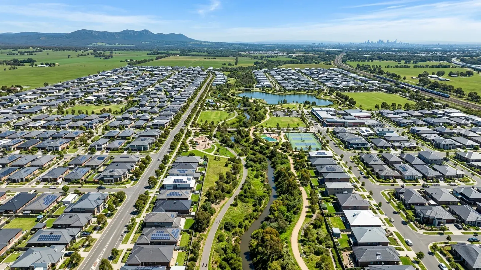
2. Civil Infrastructure, Road Networks & Arterial Bridges
The fundamental bottleneck of outer-western growth corridors has never been land supply — it has always been civil infrastructure connectivity. Anyone who drives along the Western Freeway or Melton Highway during morning peak hours knows that existing local roads are already pushed beyond capacity.
To avoid creating a car-dependent bottleneck, the approved Melton East PSP establishes a comprehensive civil transport network:
- 3 New Major Arterial Road Corridors: Designed as multi-lane transit arteries capable of handling high traffic volumes, heavy articulated vehicles, and future bus priority lanes.
- 14 Signalised & Controlled Intersections: Strategically situated at key feeder junctions to control traffic flow between local residential collector streets and primary arterial roads.
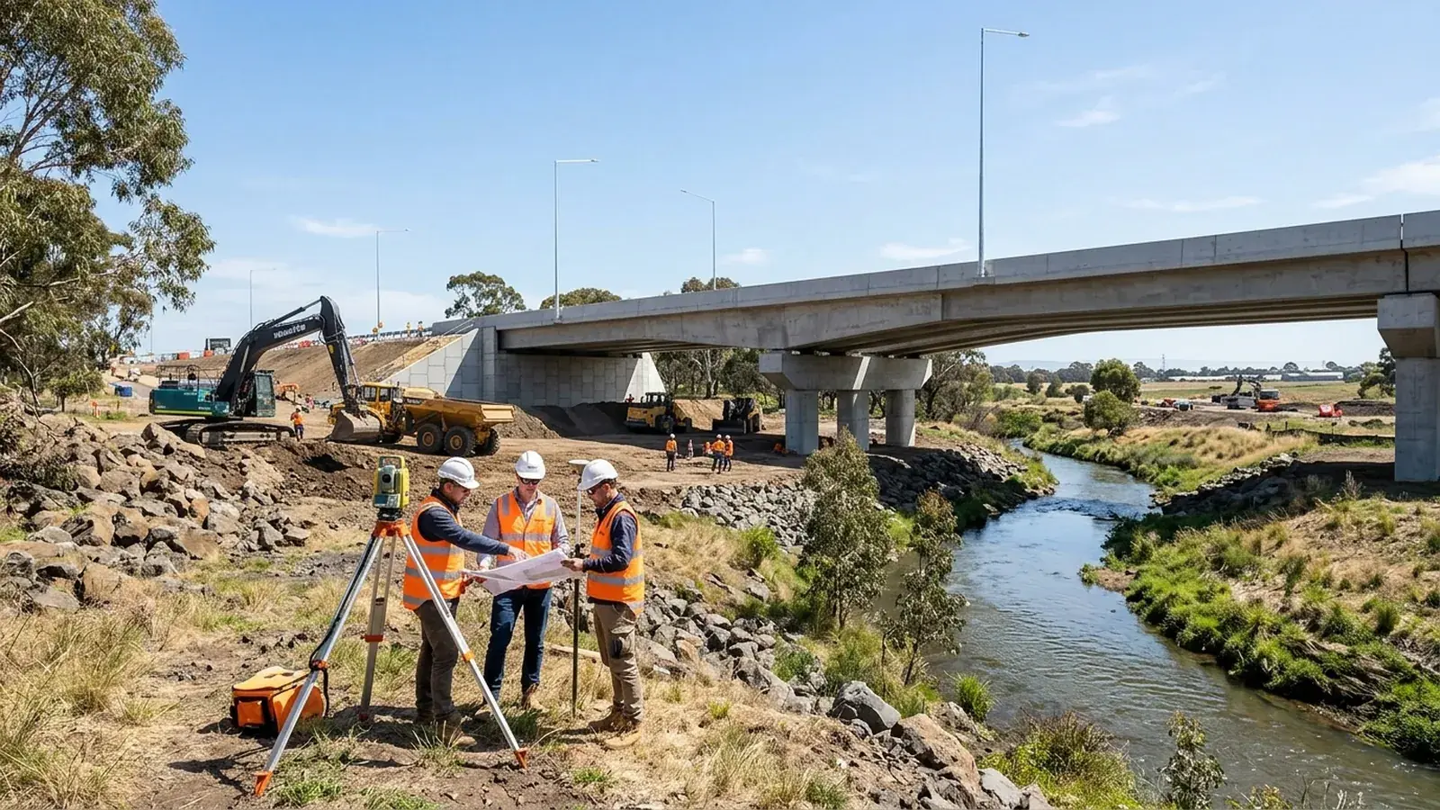
- 5 Major Structural Bridges: Critical civil engineering works designed to span watercourses and railway infrastructure. Most notably, two brand-new bridge crossings over Kororoit Creek at Tarletons Road and Paynes Road will unlock cross-corridor mobility that has been blocked by natural geography for over a century.
- Active Transport Grid: A continuous, grade-separated network of shared pedestrian footpaths and cycling trails running alongside linear parks and creek reserves, linking directly into school gates and retail plazas.
3. Educational Reserves, Retail Hubs & The 20-Minute Neighbourhood
Under the Victorian Government's Plan Melbourne 2017–2050, new precinct structure plans must embed the 20-Minute Neighbourhood principle — the concept that residents should be able to access most everyday necessities (schools, parks, groceries, medical services, and transport) within a 20-minute walk, cycle, or public transit trip from home.
In Melton East, land has been formally allocated and reserved in the statutory maps for significant civic infrastructure:
Educational Facilities (7 Planned Schools)
- 4 Government Primary Schools: Evenly distributed across residential sectors to ensure primary school children can walk to school without crossing major arterial roads.
- 1 Government Secondary School: A large multi-hectare campus centrally located with integrated sporting fields and gymnasium facilities.
- 2 Non-Government Primary Schools: Reserved parcels earmarked for future Catholic or independent educational providers.
Commercial, Retail & Civic Amenities
- 2 Neighbourhood Activity Centres (NACs): Anchored by full-line major supermarkets, specialty retail, pharmacy, medical centres, professional suites, and dining precincts.
- 2 Local Convenience Centres: Smaller corner retail hubs designed for day-to-day shopping essentials, cafés, and local services embedded in neighbourhood pockets.
- 4 Multipurpose Community Hubs: Council-operated community facilities incorporating maternal and child health consulting rooms, kindergarten rooms, and flexible meeting spaces.
4. Environmental Protection, Open Space & Cultural Heritage
Unlike early 1990s subdivisions that scraped landscapes flat, modern Victorian PSPs must meet stringent environmental standards under the Melbourne Strategic Assessment (MSA) and the Biodiversity Conservation Strategy (BCS).
Kororoit Creek Conservation (RCZ3)
The Kororoit Creek corridor running along the north-eastern edge of the site has been rezoned from agricultural land to Rural Conservation Zone 3 (RCZ3), formally designated as Conservation Area 15. This zone establishes permanent, legally binding protection for the habitat of the federally protected Growling Grass Frog (Litoria raniformis), ensuring natural riparian buffers, water quality swales, and protected breeding wetlands.
Over 5 MCGs of Public Parkland
The open space framework reserves an expansive amount of recreational land for future generations:
- 1 Regional Active Open Space Facility: Designed to host multi-sport weekend competitions (cricket, AFL, soccer, athletics).
- 3 Additional Active Open Space Grounds: Local sporting ovals with floodlighting, pavilions, and parking.
- 14 Local Neighbourhood Parks: Playgrounds, picnic shelters, and fitness circuits scattered within 400 metres of every residential allotment.
- Native Tree Preservation: High-retention-value River Red Gums and native grey box trees identified during arboricultural site audits have been granted statutory 'must be retained' protection within road reserves and parklands.
Water Management & Cultural Heritage
Stormwater runoff will be managed via Melbourne Water's Development Services Scheme (DSS) using Integrated Water Management (IWM) bio-retention basins to filter stormwater before it discharges into Kororoit Creek. Furthermore, through extensive formal consultation with the Wurundjeri Woi-wurrung Cultural Heritage Aboriginal Corporation (WWCHAC), the PSP incorporates an Aboriginal Cultural Heritage Plan and Cultural Values Assessment (CVA) to protect sensitive cultural artefact scatter sites along historical creek waterways.
5. Local Council Response & Urgent Infrastructure Funding Demands
While property developers welcomed the approval, the City of Melton Council responded on August 26, 2026, with a strong, measured statement. Mayor Cr Lara Carli stressed that whilst Council supports the state's ambitious housing supply targets, greenfield residential development without upfront State Government infrastructure funding risks repeating past planning mistakes.
“Rapid housing growth in Melbourne's west must be matched with committed state infrastructure investment. Our community cannot wait a decade after moving in to receive basic train stations, duplicated roads, and duplicated rail services.” City of Melton Council Official Response (August 2026)
Council's core infrastructure campaign centres on three vital state commitments:
- Melton Rail Line Electrification by 2030: Transforming the current diesel V/Line commuter service into a high-frequency, electrified metro train service with doubled track capacity, directly aligning with Infrastructure Victoria's 30-year priority recommendations.
- Delivery of New Railway Stations: Fast-tracking the planned but delayed passenger stations at Mt Atkinson and Thornhill Park to service eastern and northern growth catchments before Melton East achieves peak population density.
- The Outer Western Roads Package: Immediate state funding allocations to duplicate and upgrade critical arterial bottlenecks: Hopkins Road, Taylors Road, Palmers Road, and the Melton Highway.
6. Kris's Builder Notes: Ground Realities When Building in Melbourne West

What Volume Builders Gloss Over: Soil, Foundations & Drainage in Melton
"When you look at glossy estate brochures, you see green lawns and clean render. But as a licensed builder who has spent decades pouring concrete across Melbourne's western plains, I tell our clients to look at what lies beneath the grass first.
The geology across Melton and Grangefields is dominated by the Newer Volcanics basalt province. In plain English: highly reactive clay soils that swell aggressively when wet and shrink drastically during hot Melbourne summers. Almost every single allotment in this corridor tests as an Class H1, H2, or P site classification under AS 2870.
Volume builders frequently quote an unrealistically low base price, only to hit clients with $30,000 to $60,000 in 'site cost variations' once soil testing reveals basalt rock floaters, uncontrolled fill, or the need for engineered bored concrete piers down to solid rock. If you build here, make sure your builder accounts for:
- Engineered Foundation Design: Don't rely on minimum generic waffle pods. High-movement soils demand properly engineered edge beams, deepened perimeter rebate footings, or bored concrete piers.
- Site Drainage: Surface water pooling near footings is the number one cause of slab heave and cracking walls in western Melbourne. Proper falls, agricultural drains, and concrete aprons are essential.
- NCC 2022 7-Star & Condensation Standards: Western Melbourne experiences freezing winter nights and scorching 40°C summer days. Passive solar orientation, thermal break double-glazed windows, and continuous vapor-permeable wall wraps will save thousands in annual energy bills.
7. Staging Timeline & Strategic Advice for Landowners
The Melton East PSP will roll out in two distinct operational stages over a 20 to 30-year timeframe. Stage 1 will concentrate development along existing arterial frontages (Melton Highway and Western Freeway) where trunk water, gas, and electrical networks can be extended cost-effectively. Stage 2 will progress inward toward the central creek buffers as major bridge crossings are completed.
| Phase / Stage | Key Focus Areas | Anticipated Works | Builder & Investor Advice |
|---|---|---|---|
| Stage 1 (Years 1–10) | Southern & Western corridors, freeway access, primary NAC. | Civil bulk earthworks, trunk sewer extensions, first primary school, Western Freeway connector ramps. | Early land titling; prime opportunities for early-adopter commercial retail and custom residential display builds. |
| Stage 2 (Years 10–25+) | Central precinct, Kororoit Creek interface, northern secondary school. | Bridge construction at Tarletons & Paynes Rd, secondary school delivery, community hubs 3 & 4. | Medium-density townhouses, multi-unit residential infill, and lifestyle parkfront allotments. |
Actionable Advice for Property Owners in the Area:
- Understand Your Infrastructure Contribution Plans (ICP): Development levies will be charged per Net Developable Hectare (NDHa) to fund arterial roads, bridges, and open spaces. Factor these contributions into your gross margin models early.
- Watch Utility Sequencing: Just because a precinct is gazetted does not mean water, sewer, and high-voltage power are available at your boundary. Powercor and Greater Western Water lead times frequently dictate actual construction commencement dates.
- Choose a Builder Who Manages the Whole Lifecycle: From geotechnical soil tests and architectural working drawings to town planning and construction, fragmented handovers cause delays. Working with a dedicated builder-project manager ensures your timeline and budget remain protected.
8. Frequently Asked Questions (FAQ)
While statutory gazettal took effect in August 2026, initial construction involves broadacre civil engineering (bulk earthworks, trunk water, sewer main extensions, and primary arterial roads). Broad residential lot titling and domestic home builds for Stage 1 are anticipated to ramp up over the subsequent 24 to 36 months as civil infrastructure stages achieve practical completion.
The addition of 12,000 homes increases overall supply, but more importantly, it brings critical regional infrastructure: 7 new schools, 2 major shopping centres, and new arterial creek crossings. Nearby suburbs like Melton South, Brookfield, Thornhill Park, and Rockbank stand to benefit significantly from enhanced commercial amenities and accelerated advocacy for rail electrification.
Yes. The Urban Growth Zone Schedule 13 (UGZ13) actively encourages medium-density housing (townhouses, duplexes, and multi-unit developments) particularly within 800 metres of the two Neighbourhood Activity Centres, community hubs, and along major transit boulevards to achieve state density targets of 18–20 dwellings per hectare.
Kororoit Creek is a vital ecological habitat corridor for the endangered Growling Grass Frog under the Federal Environment Protection and Biodiversity Conservation (EPBC) Act and Victoria's Biodiversity Conservation Strategy. Rezoning it to RCZ3 creates permanent protective buffer zones, prohibiting destructive development while incorporating passive walking and cycling paths.
Volume builders rely on standardized floor plans and low headline contracts that often explode with site costs, soil variations, and developer design guideline rejections. A custom builder like Trajcon conducts comprehensive site-specific soil testing, tailors foundation engineering to basalt clay movement, optimizes passive solar orientation, and manages the entire build with transparent project management.


Kris is the founder and licensed builder behind Trajcon Builders & Developers. With decades of hands-on structural construction, project management, and property development experience across Melbourne and Victoria, Kris is renowned for straightforward communication, architectural precision, and building homes designed to last generations.